Chennai Field Trip Report
Monsoon Assemblages is concerned with understanding large-scale and complex phenomena, namely changing monsoon climates and processes of urban development. As an anthropologist used to working at a more intimate spatial resolution, my challenge has been to find a way of understanding aspects of these phenomena at a more relatable scale. It is often stated that monsoon rhythms influence the social life of South Asia, but urban relations with the monsoon are somewhat ambiguous. Taking this as a starting point, my research seeks to explore how people conceive of and experience the monsoon from a dwelling perspective, in order to understand how the monsoon acts as an organising principle of urban life.
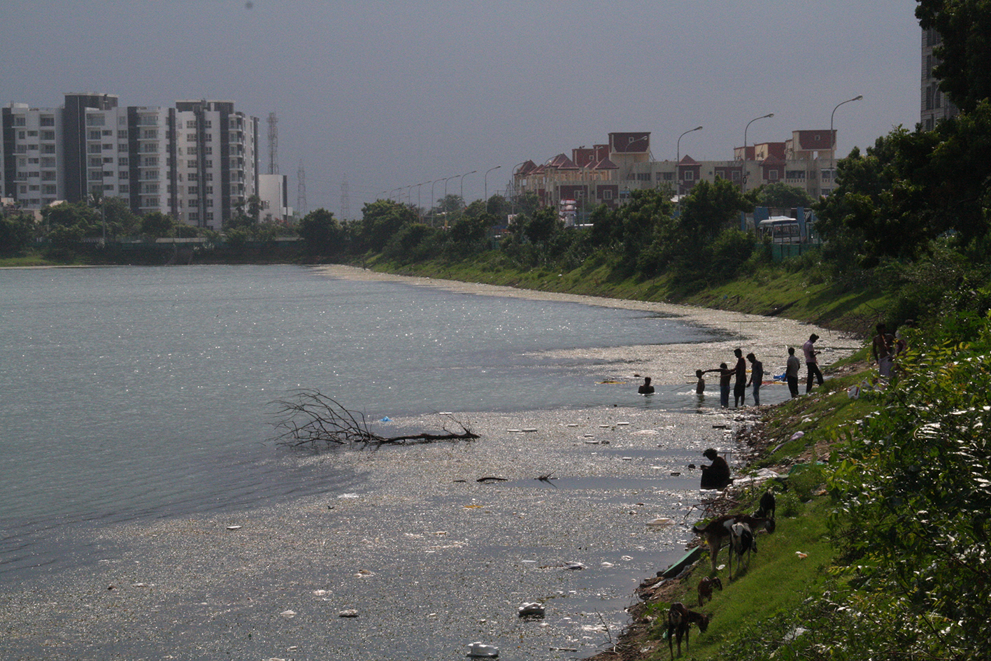
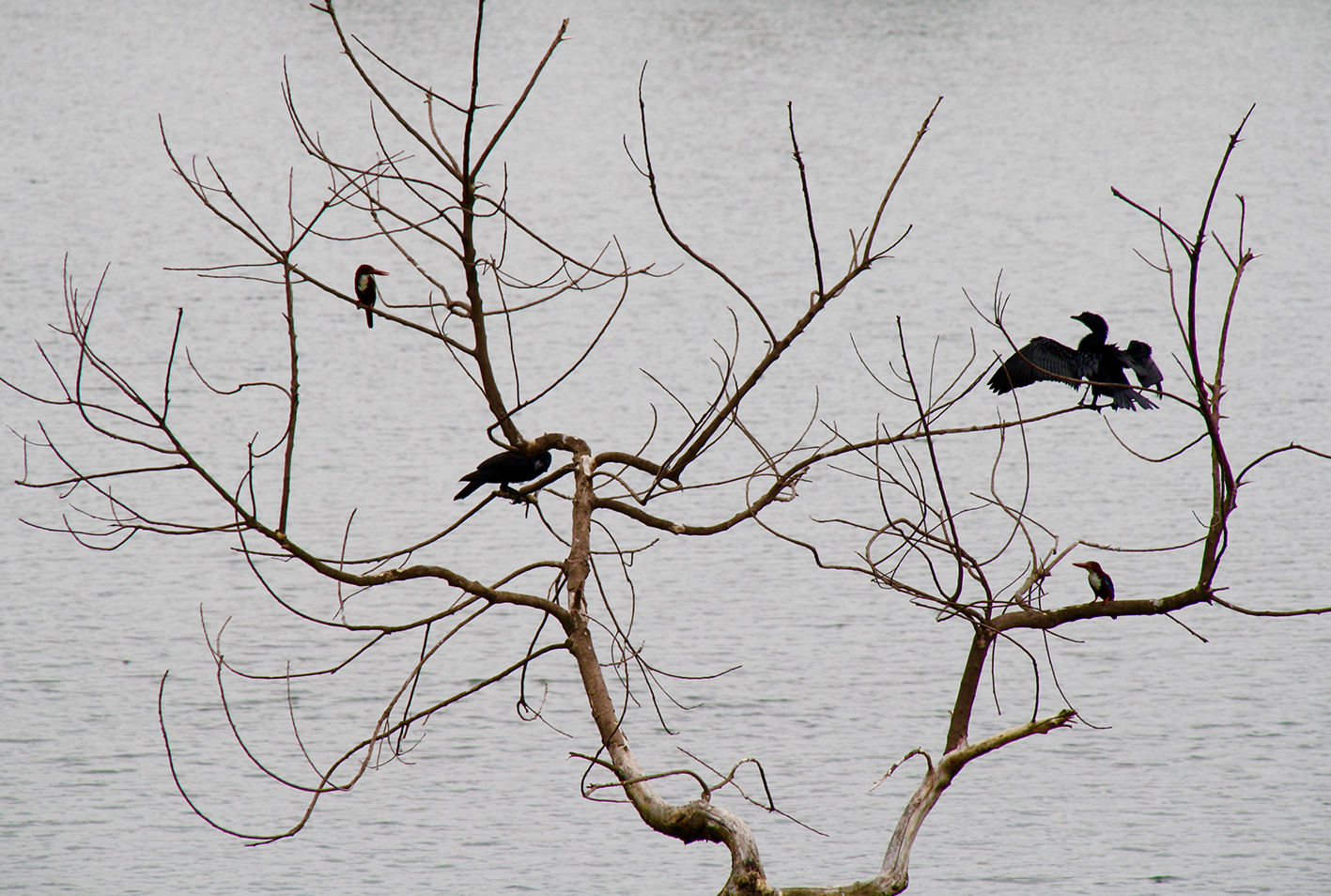
To ground my research, I focused my fieldwork on a lake situated between two important features of south Chennai, the IT corridor and the Pallikaranai marsh. The lake is a remnant of an ancient rainwater harvesting system designed to harness flows of rain and silt. Numerous such lakes, known as eris in Tamil, punctuate the landscape of Chennai and have formed an essential part of the lived environment for hundreds of years. Being dynamic entities which contract and expand according to the seasons, eris make the rhythms of the monsoon visible. They act as barometers of changing relationships with weather and environment by physically reflecting shifting human knowledge, attitudes and practices. As complex socio-ecological entities they also offer a way of understanding how plant and animal species respond to changing monsoonal patterns, landscapes and processes of environmental modification.
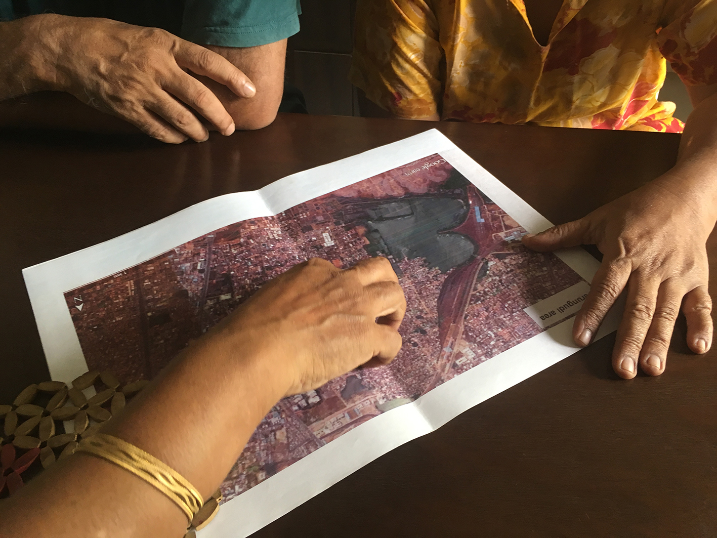
Before travelling to Chennai, I found historic maps of Chennai in the British Library’s India Office Records, which include depictions of the marsh and lake. These maps offer insights into Chennai’s colonial past and document how the landscape has changed as a result of human and more-than-human forces. To provide a counter-point to mapped perspectives, I was eager to explore lived experiences of environmental change from the viewpoint of residents who have also been protagonists in these processes. To gain access to people living around the lake, I used social media to make contact with a neighbourhood environmental association that formed to protect the lake following the 2015 floods. I attended meetings, interviewed group members and visited their homes to understand more about the group’s activities. Maps and historic Google Earth satellite imagery were used as conversational tools during discussions.
As well as interviewing residents, and local experts and activists, I spent time “hanging out” around the lake documenting infrastructure and sites of importance, as well as taking photographs and video footage of the people, plants and animals that the lake gathers. Walking was used as another mode of engagement and enabled me to sense textures, temperatures, sounds, smells and tempos. One of the most frequently walked routes took me from the busy roads and high-rise corporate office buildings of the IT corridor along the edge of the lake to the informal settlements that have mushroomed along the periphery of the marsh. This route highlighted social disparities as well as disruptions, blockages, and modifications to the local hydrology by various kinds of human interference and encroachment.
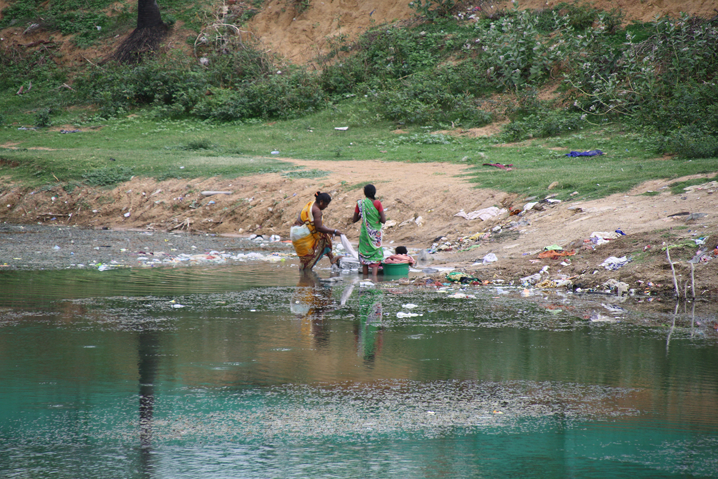
From my observations, it was apparent that middle-class environmental interventions represent just one type of human engagement with the lake. During the course of walking various other people who frequent the lakeside sought to make contact with me. Despite language barriers, particular individuals became important connections and welcomed me into their homes and introduced me to friends and relatives. As a result of these chance meetings, I gained some understanding of people’s daily lives and the rhythms of their routines and practices. Informal interactions revealed places, activities, and things of significance, including shrines, religious rituals and sacred plant species, which offer another reading of the lake, its surroundings and connections with monsoonal dynamics.

Engaging with the lake, and the various humans and non-humans that it attracts and mobilises, exposed complex ecological, social and political dynamics. The lake forms part of a contested territory with deep underlying tensions relating to access and control of water, silt and land; competing knowledges, claims and attachments to place; differential experiences of and vulnerabilities to weather and extreme weather events, all of which point to issues of power, politics and representation. By using the lake as an object with which to explore these dynamics in more depth, and by working collaboratively to find ways of representing the resulting knowledge, I hope to be able to demonstrate the multiple ways in which the monsoon is known and entangled in the fabric of urban life.
Having returned to London, my task is now to catalogue, transcribe and analyse the material generated during my time in Chennai. In the process of doing so, I will be reflecting on the themes and theoretical frameworks that have informed the design of Monsoon Assemblages in order to write a series of academic papers. I will also be working with other members of the MONASS team to explore and develop creative, visual modes of representation that can be used to produce outputs for our final exhibition. I am excited about the transdisciplinary possibilities and potentials offered by combining ethnographic data, visual modes of representation and the tools of design.