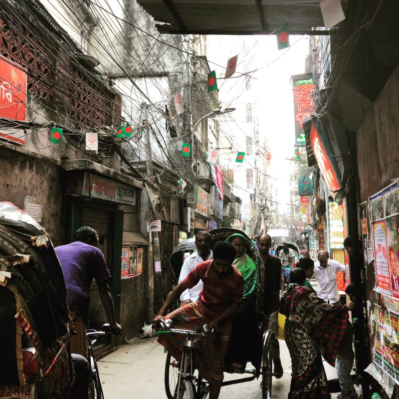
Old Dhaka. Photo by Christina Geros.
A body of brown, opaque dust hovered over the city. Easily carried by the cool, dry heat, our lungs labored heavy with particulate. Construction, relentlessly pounding; chimneys, relentlessly puffing–the business of reforming, refabricating and repackaging the earth fills the air and covers the landscape.
Pohela Falgun– the arrival of spring, warmth and light: through breaks in Dhaka’s endless traffic. Girls adorned with bright yellow flowers and saris weave their way through a sea of exhausted rickshaw drivers. A seasonal change between hot and hotter, but over the next few days its palpability undeniable–even to us.
A trip or two to the pharmacy later, we too carried the marks of this liminal period of the year…
In February, we (Christina Geros and Beth Cullen) traveled to Dhaka for a short, two-week trip to find grounding for our preliminary research within the city and its communities. Prior to our visit, we had been gathering and analyzing information about the city and its larger territory, from the Himalayas to the Bay of Bengal with the aim of finding the monsoon in Dhaka. As a city constructed of a fluvial plain, it would be easy to say, “the monsoon is everywhere”; but, our research had led us to believe that the monsoonal registers of Dhaka were uniquely situated in the material and immaterial spaces and practices of this city. Over the course of our stay, we identified three lines of inquiry for further investigation when we return to Bangladesh later in the year. Working from the heart of Old Dhaka to the dynamics of the larger territory, we will spend the next few blog posts briefly unpacking each of them.
Dholai Khal
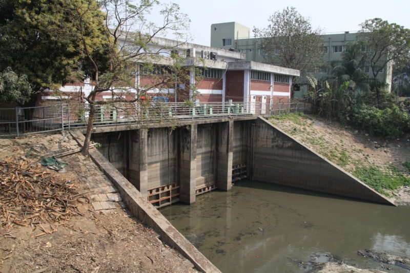
Dholai Khal switch gate at the entry of the Buriganga. Photo by Beth Cullen.
Our explorations started along the edge of the Buriganga River where we found what locals call the ‘switch gate’, marking the mouth of the old Dholai Khal canal. Until recently over 50 such canals, or ‘khals’, criss-crossed the city. The Dholai Khal, constructed in the early seventeenth century, was one of the most important. It provided protection and an essential transportation route along which boats could move into the city. According to residents, the status of the canal changed during the 1970s when the sluice gate and pumping station were constructed, severing the connection with the river.

Tracing the Dholai Khal into the city. Photo by Beth Cullen.
We attempted to follow the canal from the sluice gate into Old Dhaka. A small open section remains, but it is substantially narrower than it was in the past. It now lies neglected, filled with rubbish. About 300 metres from the river the canal is replaced with concrete box culverts and disappears beneath a road. The filling in of canals for the construction of roads is partially responsible for the flooding that the city experiences during the monsoon season. Rivers, streams, khals and wetlands have been replaced by embankments, sluice gates, storm water drains and pumping stations. We managed to trace the route of the former canal along its replacement road to an old junction point. All that remains is an abandoned pond hidden from the street behind concrete walls.
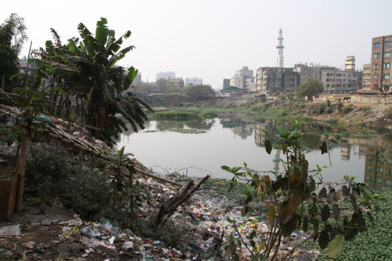
Small reservoir left behind at an old junction point of the Dholai Khal. Photo by Beth Cullen.
Buckland Bund
From the Dholai Khal we walked along the ‘Buckland Bund’, an embankment constructed in 1864 to protect Dhaka from river erosion and flooding. The bund was also intended to improve the workings of the Sadarghat, a bustling river port situated on the banks of the Buriganga River. The muddy, tidal foreshore of the river made the loading and unloading of cargo difficult. The ‘problem’ of the river was rectified by the creation of a raised and defined edge.
The Buckland Bund near the Dholai Khal entry into the Buriganga. View from the river; photo by Beth Cullen.
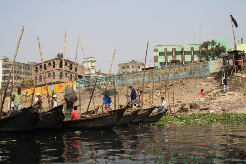
As one of the city’s first embankments, the Buckland Bund became a significant waterfront and a prime residential location for the wealthy. Over time Old Dhaka has been superseded by newer, upmarket neighbourhoods. The city has gradually turned its back on the river and although the Buriganga is still relied upon for the movement of goods and materials, it is no longer respected. As a convenient dumping ground for industrial waste, tannery effluent and sewage the river is considered to be biologically dead. People living along the edge of the Buriganga welcome the cleansing and flushing effects of the monsoon rains. Making our way along the bund we passed through the Sadarghat Market which supplies Dhaka with fresh fruit and vegetables. Produce arrives daily from different regions of Bangladesh. We watched traders unloading boats piled high with winter vegetables – potatoes, cauliflowers, cabbages, brinjal, radishes and pumpkins. Both the produce and the trade routes change with the seasons; the waterways expanding during the wet season and shrinking during the dry season, shifting with the rhythms of the monsoon.
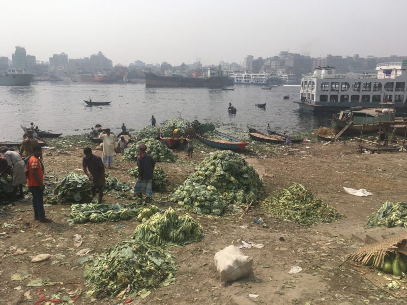
The Buckland Bund now operates as a landing and staging area for goods, particularly produce, arriving into the city. Photo taken at Sadarghat Market by Beth Cullen.
The history and tradition of canals in Old Dhaka certainly holds valuable knowledge of monsoonal living spaces. As we continued our explorations of the city, from its dense urban core to its sprawling edges, these knowledges and the spaces built by them remained in our forethoughts.
Dhaka, Part One: Discovery written by Beth Cullen and Christina Geros.
For more images and snippets from our trip, find us on Twitter and Instagram: @monass_2016